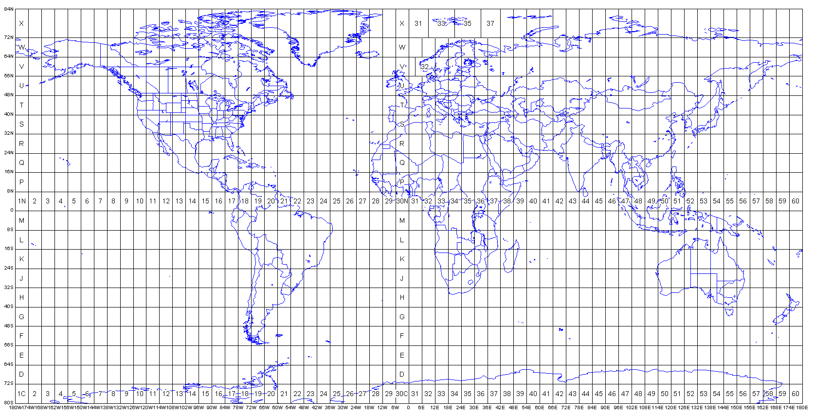
Below is mapping of grid zones of the world compiled by Alan Morton but modified through numbering by 21st Century Polymath. The first one by Alan just shows the grid zones as they are but the second one by 21st Century Polymath is a numbering of the zones so that each zone has an address . Thus we have come up with 1197 zones as per Alan's map.
Numbering of zones is useful in locating regions with ease and employing new alternative naming systems .For example instead of referring to Portugal by its co-ordinates you can use the numbered zone system hence calling Portugal 622 and 623 .This is because two of these zones cover Portugal . If you want North Portugal you just call it 622 as per the map since the co-ordinate ranges vary in most maps .
Of course it is known that co-ordinates differ in range as some co-ordinate ranges are the same both longitudinally and latitudinally while Alan's has two different ranges with the latitude co-ordinates having a range of 8 degrees while the longitudes have a range of 6 degrees.
This difference in ranges means that the numbering of zones will also vary . thus in this case we have numbered Alan's map and thus employed his co-ordinates.
21stCentury Polymath
UTM Grid Zones of the World compiled by Alan Morton

There are 60 longitudinal projection zones numbered 1 to 60 starting at 180°W. Each of these zones is 6 degrees wide, apart from a few exceptions around Norway and Svalbard.
There are 20 latitudinal zones spanning the latitudes 80°S to 84°N and denoted by the letters C to X, ommitting the letter O. Each of these is 8 degrees south-north, apart from zone X which is 12 degrees south-north.
Areas are referenced by quoting the longitudinal zone number, followed by the latitudinal zone letter. For example, the southern end of South America is 19F.
Within each longitudinl zone the transverse mercator projection is used to give co-ordinates (eastings and northings) in metres.
For the eastings, the origin is defined as a point 500,000 metres west of the central meridian of each longitudinal zone, giving an easting of 500,000 metres at the central meridian.
For the northings in the northern hemisphere, the origin is defined as the equator.
For the northings in the southern hemisphere, the origin is defined as a point 10,000,000 metres south of the equator.
The co-ordinates thus derived define a location within a UTM projection zone either north or south of the equator, but because the same co-ordinate system is repeated for each zone and hemisphere, it is necessary to additionally state the UTM longitudinal zone and either the hemisphere or latitudinal zone to define the location uniquely world-wide.
NUMBERED GRID ZONES BY ARTHUR OWITI ...FROM THE NORTH EAST (1) TO THE SOUTH WEST (1197) AS PER ALAN MORTON'S MAP.

No comments:
Post a Comment